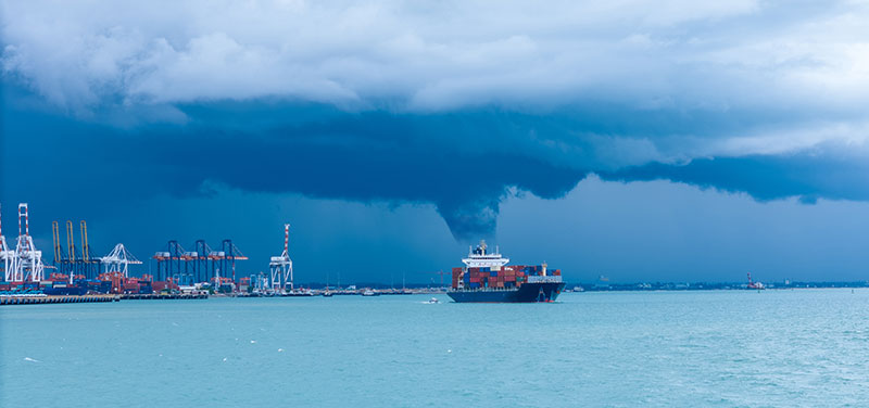
When late spring comes around, conversations among Houston residents shift from fun and entertaining baseball talk to some serious hurricane discussion. According to a study, Greater Houston is one of the most vulnerable urban areas in the world when it comes to tropical storms and hurricanes, in part because of its proximity to the Gulf of Mexico (more on this below).
With the city being home to 2.3 million people, the potential impact of this disaster could be catastrophic. That is why learning about the hurricane season is crucial.
However, understanding the exact timing of when a hurricane will potentially hit Space City isn’t just about marking the calendar. It’s about survival, property protection, and peace of mind in America’s fourth-largest city.
Hurricane season in Houston officially runs from June 1 to November 30. It’s the same window that applies to the entire Atlantic basin. But, here’s what industry veterans will tell you: The devil’s in the details, and those details can mean the difference between minor inconvenience and disastrous damage.
Houston’s Peak Hurricane Danger Window
While hurricane season spans six months, meteorologists consistently point to a much narrower timeframe for heightened concern. The majority of hurricanes affecting the Houston area have typically occurred between mid-August and mid-October. This period represents what emergency management specialists call the “danger zone” for Houston specifically.
Emergency coordinators emphasize this window because it coincides with peak water temperatures in the Gulf of Mexico… and warm water, as any meteorologist will explain, is hurricane fuel.
In addition, during these peak months, Houston sits in the crosshairs of multiple storm patterns. Weather professionals explain that late-season storms often intensify rapidly in the warm Gulf of Mexico waters, giving residents less time to prepare. Hurricane Harvey in August 2017 exemplified this pattern. Harvey grew from a tropical depression to a Category 4 hurricane in around two days.
Meanwhile, September historically produces the most hurricane activity.
Houston’s Hurricane Patterns
Professional storm trackers have identified distinct patterns in Houston’s hurricane history that every resident should understand. There are clear seasonal and cyclical trends that emergency management professionals monitor closely.
Early Season Storms
Early season storms are those that form in June and early July. In general, hurricane landfalls along the Texas coast are rare in June.
Mid-Season Hurricanes
Mid-season hurricanes, or those that form from August to September, present the greatest overall threat. Industry specialists observe that these storms often undergo rapid intensification, a phenomenon that’s becoming increasingly common according to recent climate research. Hurricane Ike in 2008 demonstrated this pattern perfectly. Ike intensified rapidly before making landfall southeast of Houston.
Late-Season Systems
Late-season systems are those that develop from October to November. They arrive less frequently but can catch residents off guard. Professional emergency managers note that late-season preparedness often lags because people assume the danger has passed.
Houston’s Geography & Urbanization Make It Particularly Vulnerable to Hurricanes
Houston’s location creates what meteorologists describe as a “meteorological bull’s-eye.” The city sits roughly 50 miles inland from the Gulf of Mexico. It is close enough to experience the full force of storm surge and hurricane-force winds and yet far enough inland to accumulate massive rainfall totals as storms slow down over land.
Emergency management professionals consistently emphasize Houston’s elevation challenge too. The city averages just 80 feet above sea level. This topography, combined with the region’s clay soil composition and the city’s flat terrain and rapid development, creates drainage nightmares during major storm events. It’s a perfect scenario for water accumulation.
“Urbanization is generally associated with a significant reduction in storm-water infiltration,” Gabriele Villarini, associate professor of civil and environmental engineering and director of IIHR once said. “Houston has experienced one of the most impressive urban-development booms in U.S. history, and with growth comes an increase in impervious surfaces. This increase in urbanization, combined with the region’s flat clay terrain, represents a very problematic mix, even with flood-mitigation measures in place.”
In addition, Houston’s rapid urban development has significantly altered local weather patterns. Concrete and asphalt create what urban planners call “heat islands,” which can actually strengthen approaching storm systems. Additionally, all that development has eliminated natural drainage areas that historically absorbed excess rainfall.
The Bayou City is called as such because of its bayou system. While iconic to Houston’s identity, it presents both benefits and challenges during hurricane season. These waterways can handle normal rainfall, but they can quickly become overwhelmed during major storm events, which leads to the widespread flooding that has become Houston’s signature disaster scenario.
Other Factors That Determine Houston’s Hurricane Risk
Experienced storm watchers know that calendar dates only tell part of the story. Sea surface temperatures, atmospheric pressure patterns, and something called the African Easterly Jet all influence hurricane development and intensity.
Gulf of Mexico
Gulf of Mexico water temperatures typically peak in late August and early September. This creates optimal conditions for storm intensification. According to oceanographic data, water temperatures above 80 degrees Fahrenheit provide the energy needed for hurricane formation and strengthening.
“Warmer air holds more water. It’s fundamental,” Emily Becker, a University of Miami research professor and co-author of the National Oceanic and Atmospheric Administration’s (NOAA) ENSO blog, explained to Live Science. “That’s a factor in why we’re seeing some hurricanes deposit unbelievable amounts of rain — it’s partly due to the higher moisture capacity of the atmosphere.”
Brian McNoddy, climatologist at the University of Miami, told Vox that the average temperature of the Gulf’s waters is near 90 degrees, which makes it the hottest it’s been in the modern record. Houston’s proximity to these warm waters means storms can intensify right up until landfall.
El Niño and La Niña
El Niño and La Niña patterns significantly influence Houston’s hurricane risk from year to year. During El Niño years, increased wind shear typically suppresses hurricane activity in the Atlantic basin. La Niña years, conversely, often produce more active hurricane seasons with increased threats to the Gulf Coast.
According to the NOAA, these effects are primarily the result of changes in the vertical wind shear. Wind shear describes how the wind changes in speed and direction with height. In vertical wind shear, these changes in wind speed and direction occur between around 5,000 to 35,000 feet above the ground.
“El Niño tends to increase vertical wind shear, and vertical wind shear tears apart hurricanes,” Phil Klotzbach, a research scientist and hurricane forecast expert at Colorado State University, told Live Science. “Consequently, [without El Niño], we anticipate relatively hurricane-favorable wind shear patterns….”
Atlantic Multidecadal Oscillation
Professional forecasters also monitor something called the Atlantic Multidecadal Oscillation (AMO), a climate pattern that’s based on the average anomalies of sea surface temperatures (SST) in the North Atlantic basin and operates on roughly 60- to 80-year cycles. The AMO can influence weather conditions in North America as well as in Europe and Northern Africa.
When the AMO is in its positive phase, which is characterized by warm SSTs, hurricane activity generally increases across the Atlantic basin. It means more North Atlantic hurricanes. On the contrary, the negative phase means cool surface waters, which translates to fewer hurricanes hitting the country.


