The short answer is: Yes, Buffalo, New York, gets a lot of snow. Based on data from 1991 to 2020, the city receives 95.4 inches of snow annually, according to the National Centers for Environmental Information (NCEI) of the National Oceanic and Atmospheric Administration (NOAA).
This is more than the around 55 inches of snow that the state of New York receives, on average, per year, but less than what Rochester and Syracuse experiences annually. Rochester, about 70 miles east of Buffalo, gets 102 inches of snow in a typical winter, while Syracuse, receiving 127.8 inches of snow in winter, tops lists of the snowiest city in the United States.
Buffalo, of course, receives the bulk of this snowfall during winter with 70.1 inches, followed by 16.6 inches in the spring, and 8.7 inches in the fall. Like most of the people living in the Midwest and the East, Buffalonians see the most snow in January. But, the first snow typically starts falling in mid November, according to the National Weather Service (NWS), brought about by cold fronts from Canada in late October. The first snowfall in the city also signals the start of the lake effect season.
Later in the season though, there may be concerns that floods will claim Buffalo residents’ homes and reak havoc on the landscape. In a recent news story, NBS News shared, “The New York State Division of Homeland Security and Emergency Services warned in a tweet that “the mix of higher temps, rain & snowmelt may cause basement flooding, ponding of water in low-lying areas & ice jams” and urged people to contact their local fire department or emergency management office if they have concerns about flooding,”.
Let’s get back to the snow…
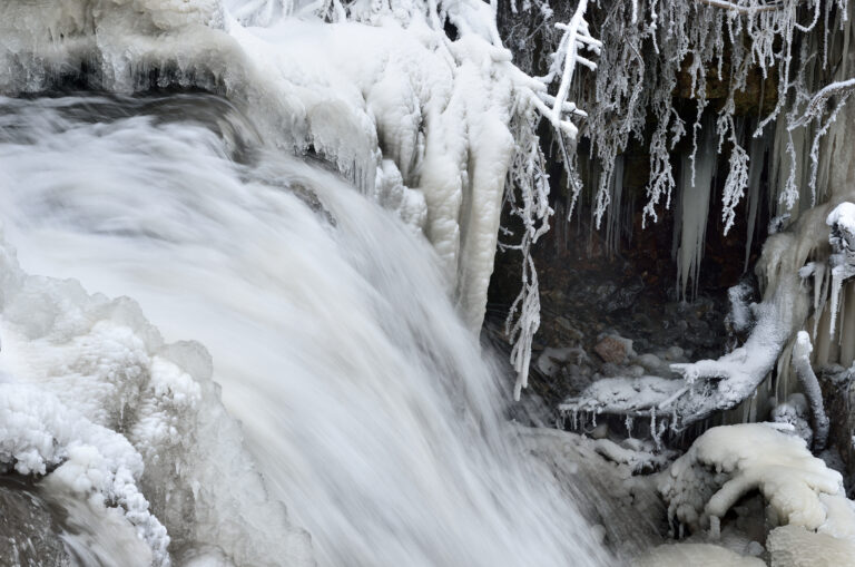
Lake Effect Snow in Buffalo NY
There are three conditions necessary for snow. First, the atmosphere and the air near the ground must be below freezing (32° Fahrenheit or 0° Celsius). Second is the position of the jet streams, which are narrow bands of strong wind that typically hang out at about 30,000 feet (9,100 meters) in the upper atmosphere. These rivers of air move along a west to east, but sometimes north and south, route following the boundaries between hot and cold air. They are strongest in winter time and facilitate the meeting of warm, moist air and cold air, which is the third condition for snow.
In the Great Lakes, when cold, dry air, often originating from Canada, moves over an unfrozen and warm body of water, it becomes like a sponge soaking up moisture from the lake. This results in a column of warm air called a thermal which is pushed upwards. When thermals cool down and condense, they become cumulus clouds that bring lake effect snow. Bay effect and sea effect snow are similar phenomena that occur over other bodies of water.
Topography and the wind’s speed and direction impacts where the snow will fall. Snow typically pours on the southern and eastern shores downwind of the Great Lakes. Wind speed and direction will dictate the width and length of the snow bands, whereas topography affects snowfall rate. For instance, hills and high lands push air upward, making it cooler and resulting in greater snowfall.
Other factors can influence lake effect snow, including cities, industries and automobile exhaust. The Great Lakes region is a global leader in iron and steel manufacturing, which emits particles that encourage snowstorms. Automobile exhaust coughs up lead which combines with natural iodine in the air encouraging the formation of ice crystals. Cities, on the other hand, provide additional warm air which adds to development of lake effect snow.
Snow which can begin falling as early as mid November peaks in December and starts to wane by January and February as Lake Erie freezes. The amount of snow that falls from late fall and all through the winter months can be as much as 2 to 3 inches (about 5 to 8 cm) per hour. Total snowfall can range from 60 to 100 inches (around 150 to 254 cm).
October Surprise in Buffalo NY
Lake effect snow bands often bring with them intense snowfall that can happen at any moment. It’s not unusual for areas basking under sunny skies to unexpectedly be covered with a snow wall in a matter of minutes. It’s also common to see one part of town drenched in sunlight while another area, say a mile or two away, experiences heavy snowfall. This variability can lead to limited visibility and endangers motorists.
These snowfall are highly localized and often come unexpectedly as was the case in October 2006. While Buffalorians are familiar with snow storms, they typically expect such storms to occur between November and February, so it was a surprise to experience lake effect snow in October. As such, the natural event was aptly named October Surprise by locals who were caught off guard by the inches of heavy snow that accumulated for a short period of time.
“This is an extremely rare event for this early in the season,” meteorologist Tom Niziol told WIS News 10. He was referring to the historic 8.3 inches of snow that fell on Thursday, October 12, eclipsing the previous record of 6 inches on October 31, 1917.
The snow was so heavy that branches were bowed by the sheer weight of the white powder and appeared like weeping trees. Many snapped under the burden and lay strewn across roads.
“The whole house shook,” Buffalorian Joan Casey told the TV station, referring to the impact of the box maple tree that split in half and fell on her house. “We were very afraid. Originally I thought it was just the thunder, and then I came outside and I couldn’t believe it.”
Power lines were damaged and many homes and businesses were without power the following day.
“This is extremely heavy snow and most of the trees still have most of their leaves,” National Grid spokesperson Steve Brady explained to WIS News 10. “We can’t do a complete damage assessment until the snow stops falling.”
With snow falling over an inch per hour, roads were blocked and unnecessary driving was banned. “We have a condition where 80 percent of the roads are impassable,” Lt. Stephen McGonagle of the Amherst Police Department told the TV station.
Lake Effect Snow Belts in the Great Lakes
Lake effect snow is experienced in the Great Lakes and the east shore of the Hudson Bay. Elsewhere in the world, lake effect snow falls on the west coasts of Honshu and Hokkaido islands in Japan.
In the Great Lakes area, lake effect snow occurs in the following snowbelts. Stretching from eastern Cleveland, Ohio to Buffalo, New York is the Lake Erie snowbelt. Lake Erie is the only Great Lake that freezes over completely. East of Buffalo, Syracuse receives lake effect snow from Lake Ontario.
The other three Great Lakes snowbelt are the Lake Huron snowbelt, Lake Michigan snowbelt, and the Upper Peninsula snowbelt. Lake Huron snowbelt affects much of Southern Ontario. Lake Michigan snowbelt impacts Northern Indiana and Western and Northwestern Lower Michigan. Meanwhile, the Upper Peninsula snowbelt covers the area from Porcupine Mountains and the Keweenaw Peninsula to Whitefish Point.